

January 2, 2026 Conditions Report with Mitch Sulkers
The Incoming Storm—Certainty, Uncertainty, and Situational Awareness
Well, we have enjoyed a period of green brick (forecast avalanche danger at all elevations green) for a couple of days since our last storm rocked the neighbourhood in the southern Sea2Sky, and to a great extent, the damage from warmer temperatures, especially at elevation and on polar aspects, has been negligible.
But now we have forecasts starting to agree that we have some form of a two-day storm coming in with some rising freezing levels and uncertain amounts of new snowfall. Saturday and Sunday look to be the storm days, with snow beginning later on Friday evening. The totals suggest that, with wind that accompanies the storm, there will be enough accumulation to erase our green brick and raise the avalanche danger ratings possibly to High, at least in the alpine, with Considerable at treeline.
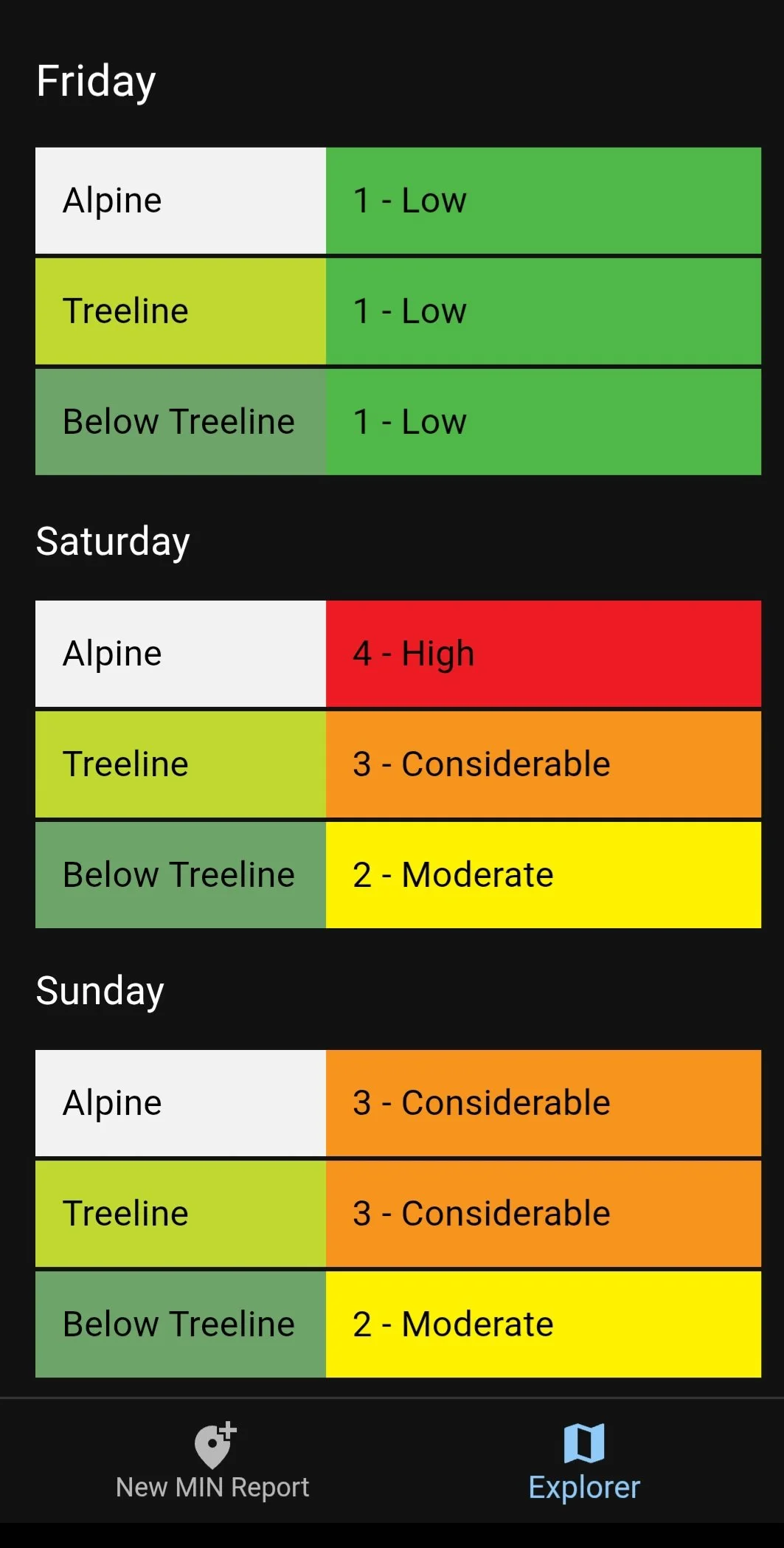
Our first concern could well be the forecast avalanche danger in terms of the terrain we would hope to access. With alpine areas being rated at High avalanche danger for Saturday, and concerns like wind and visibility also likely, it might seem best to avoid alpine regions during the height of the storm.
However, the treeline rating of Considerable, combined with the protection that trees afford from wind, in particular, might seem more suitable for touring during this period. The reality is, at the same time, Considerable is still a difficult avalanche danger rating to manage: avalanches may not be as certain as in times of High rating, but they are still likely to occur, and they will be large enough to cause damage and to be triggered by tourers.
So, what approach makes the most sense?
Let’s focus on the treeline issue.
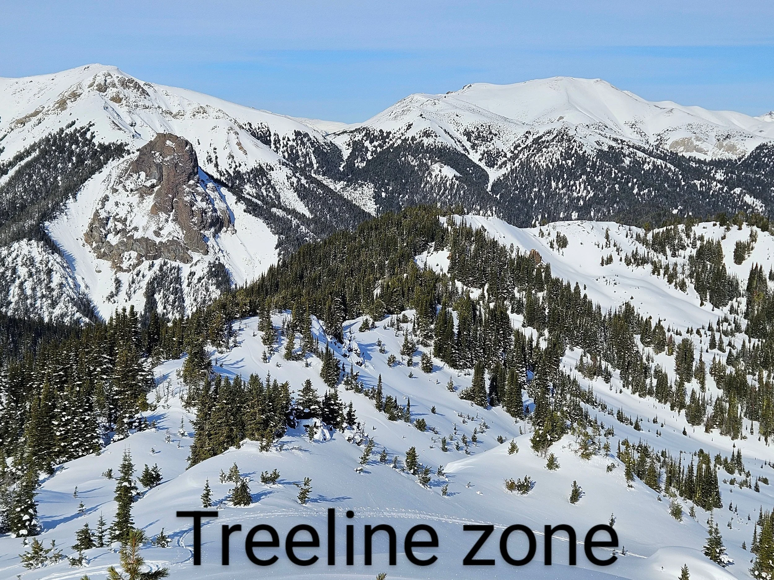
Depending on where you choose to recreate in the corridor, current surfaces vary greatly according to aspect and elevation, varying again from south to north. Observations during the week still show significant surface hoar deposits, especially in treeline areas protected from wind and solar radiation.
Surface hoar is a difficult weak layer to manage and is a significant concern as storm slabs build during the forecast period. It will be necessary to observe very carefully in these zones to determine if surface hoar survives the early storm, but treating areas protected by trees from sun and wind, especially below ridge crests, will be very important.
In the mid-to-northern areas of the corridor, polar aspects, even at treeline, have shown a well-settled right-side-up snowpack, with the surface crystals generally still facetted from the low temperatures experienced after the last storm. Clear nights rejuvenated surface crystals even below treeline elevations in central Garibaldi Park. These crystals will also be unlikely to make a good bonding layer to the new storm snow, which is likely to come in at a higher density, creating an upside-down cake scenario, with heavier snow over lighter, less cohesive snow.
The need for Situational Awareness
With the uncertainties outlined above, it will be particularly important to be especially situationally aware during this forecast period. Regular and effective snow observations will be a key component: snowfall accumulation, wind speed and direction, temperature trends, signs of cracking, whumpfing, or settling during movement.
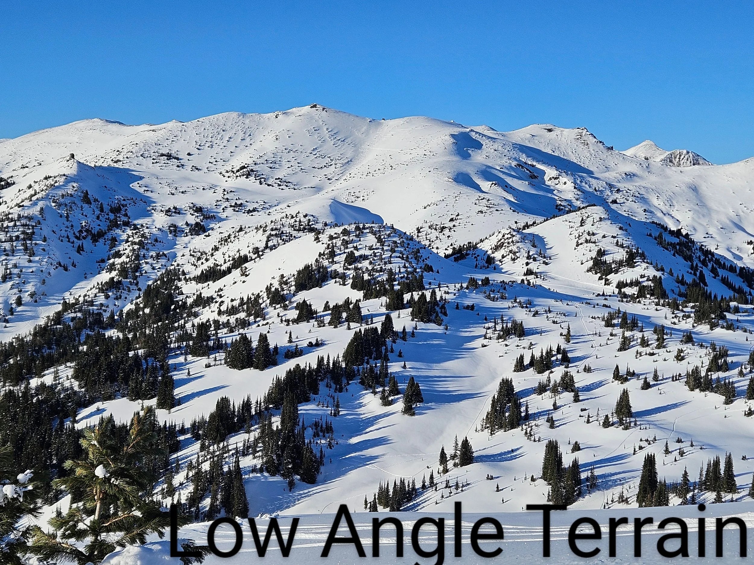
Further, be acutely aware of the terrain you intend to be in and the terrain you are in. Choose small low-angle (less than 30 degrees), linear or concave slopes to test the snow, and stay away from terrain traps entirely.
If the storm passes through by morning hours Sunday morning, be especially concerned about launching into bigger, more consequential terrain than would have been appropriate Saturday. In a time of forecast rapid change, it is best to err on the side of caution.